Osage Hills State Park
|
|
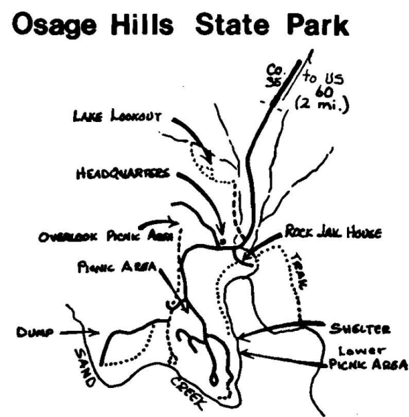
Sand Creek Route The park, containing 987 acres, is cut by Sand Creek. While the count: is rugged, all primary roads are blacktop and good. The route consist of wooded hillsides and scrubby border along the water's edge, with a variety of habitats. If trails are wet or overgrown, most areas are accessible by road. The park may be reached west of Bartlesville or from Pawhuska via US 60, driving 2 miles south on SH 35 to the entrap, Follow signs to the picnic-swimming pool area to reach the lower picnic area, about 4 miles. Park here and walk 0.5 mile to Sand Creek Falls. Return by a trail along the edge of Sand Creek to the shelter house. In spring look for Louisiana and Northern waterthrushes; Kentucky, Prothonotary, Northern Parula, Tennessee and Yellow-throated warblers; Warbling, Red-eyed, Bell's, and White-eyed vireos; Chipping and Song sparrows, and Blue Grosbeaks. In winter there are Wild Turkeys, the usual woodpeckers including the Pileated, members of the Tit family, Song,, Fox, White-crowned, and White-throated sparrows. In summer there are hawks, woodpeckers, Blue-gray Gnatcatchers, Indigo Buntings, and Belted Kingfishers. Red-tailed Hawks nest in the area. Early spring and late fall are the two best periods during the year for birding. The best time of day is after sunup and before the picnickers arrive. A Greater Roadrunner has for many years been seen near the Park entrance off US 60. Turkeys sometimes feed at the headquarters in winter and can be seen across Sand Creek in flocks in early morning and late evening. The trail south of the camping area is the road to the dump. It is sometimes passable by car, at least to the dump at the end. The circle walk is about three-fourths mile long. The road is usually muddy and rutted. Walking is advised. The area is good for winter birds. Sand Creek Tributary Route From the entrance drive approximately 2 miles to just past the turn-off to Lake Lookout. Cross the bridge and park on the left off the road. The usually muddy road on the left leads to the old "Rock Jail House". Follow the dirt road on foot to the east to a wide, open grassy area. Circle it and turn back. The area is about a half mile from the car. Follow any of the other fishermen roads in the area or take the longer trail (not kept up) to the picnic area about 0.5 mile south. The walking route leads through wooded bottoms and open grassy areas along a creek running Into Sand Creek. This tributary is located in the central section of the park. The 18-acre Lake Lookout was formed from the small tributary to Sand Creek. In spring there are Eastern Bluebirds, Bewick's Wrens using nest boxes, vireos, warblers, and grosbeaks. In summer look for hawks nesting in tall timber near the creek, woodpeckers, and Eastern Phoebes. Springtime from sunup to noon is the best time to visit the area.
|
 |